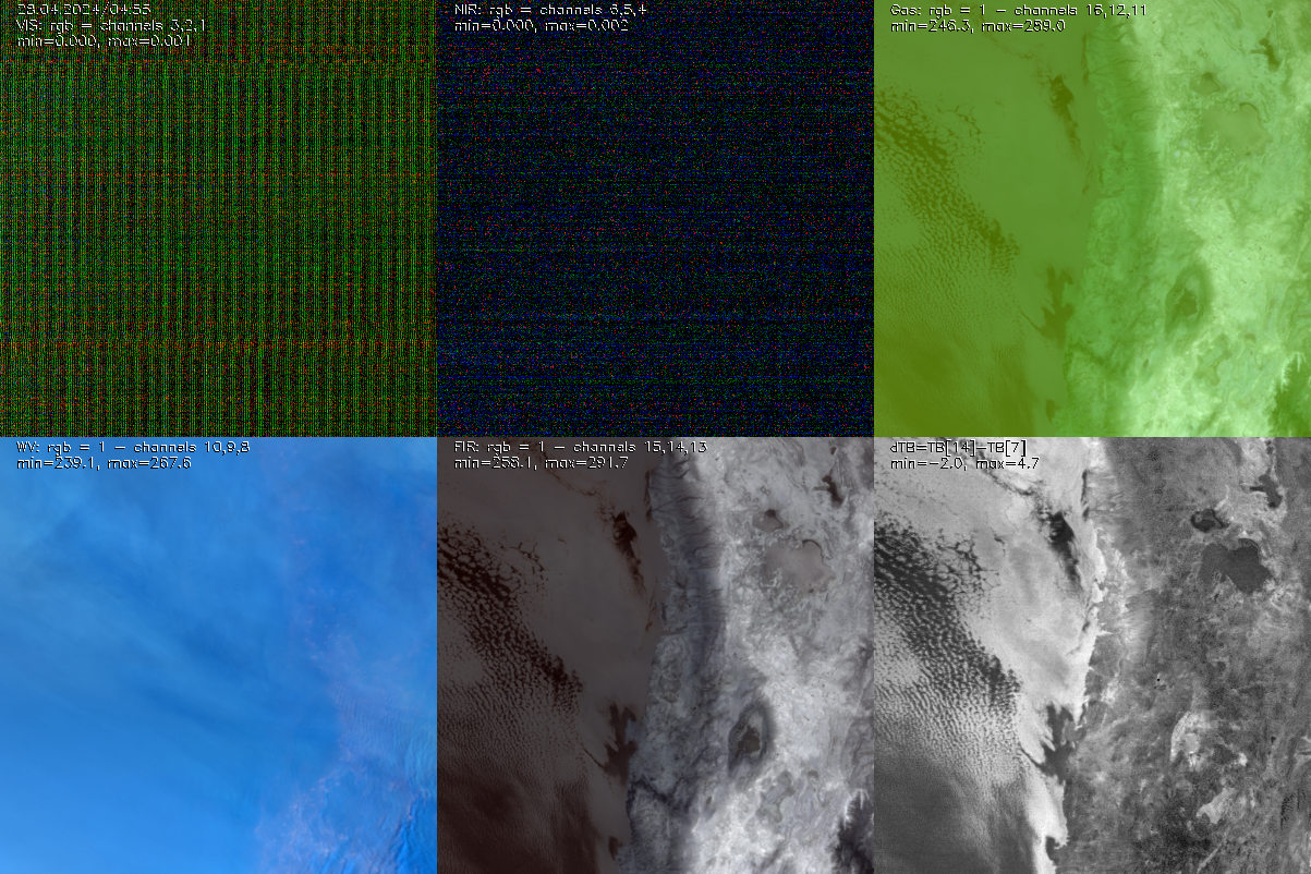
Atacama now (multi channel)
move your mouse over the image
RGB composits from GOES16 ABI data.
Top left: visible channels, top center: near infrared channels, top right: Cloud top Temp., O3 and CO2 channels,
bottom right: water vapor channels, bottom center: far infrared channels, bottom right: brightness temperature difference of channels 14 and 7.
Data was aquired via Amazon S3 Bucket at Google cloud by aws calls.
See also all channels, whole globe at nesdis.noaa.gov.
Channels:
| Chnl | wvl | bwdt | SNR | Res | |
|---|---|---|---|---|---|
| nm | nm | @100%albedo | km | ||
| 1 | 470 | 40 | 300 | 1.0 | blue visible |
| 2 | 640 | 100 | 300 | 0.5 | red visible |
| 3 | 860 | 40 | 300 | 1.0 | 'veggie' NIR |
| 4 | 1380 | 30 | 300 | 2.0 | 'cirrus' NIR |
| 5 | 1610 | 60 | 300 | 1.0 | 'snow/ice' NIR |
| 6 | 2260 | 50 | 300 | 2.0 | 'cloud particle size' NIR |
| Chnl | wvl | bwdt | ΔT | Res | |
| μm | μm | K@300K | km | ||
| 7 | 3.90 | 0.20 | 0.1 | 2.0 | 'short wave' IR |
| 8 | 6.15 | 0.90 | 0.1 | 2.0 | 'upper trop. water vapor' IR |
| 9 | 7.00 | 0.40 | 0.1 | 2.0 | 'mid trop. water vapor' IR |
| 10 | 7.40 | 0.20 | 0.1 | 2.0 | 'low trop. water vapor' IR |
| 11 | 8.50 | 0.40 | 0.1 | 2.0 | 'cloud top phase' IR |
| 12 | 9.70 | 0.20 | 0.1 | 2.0 | 'Ozone' IR |
| 13 | 10.3 | 0.50 | 0.1 | 2.0 | 'Clean IR window' IR |
| 14 | 11.2 | 0.80 | 0.1 | 2.0 | 'IR window' IR |
| 15 | 12.3 | 1.00 | 0.1 | 2.0 | 'dirty IR window' IR |
| 16 | 13.3 | 0.60 | 0.3 | 2.0 | 'CO2' IR |